American Bald Eagle

American Bald Eagle

ABOVE WISCONSIN PORTFOLIO

American Bald Eagle Drone Media

Scenic Door County aerial media with wildlife and destination storytelling potential.

Location
Door County, Wisconsin

Project Type
Tourism, wildlife, destination content

Media Focus
Tourism & Destinations, Events & Community, Video & Editing

Useful For
Tourism and destination media, Scenic social content, Wisconsin visual storytelling

Tags
Tourism & Destinations | Events & Community | Door County | Door County Drone Pilots

Project Media Preview

Featured Aerial View

Project Perspective

THE NEED

Visual Context

Tourism and nature content depends on patience, location awareness, and a sense of place. The goal is to capture a memorable Wisconsin visual without overcomplicating the story.

THE APPROACH

What Above Wisconsin Captured

Above Wisconsin captured a distinctive Door County aerial perspective that can support tourism storytelling, social content, scenic reels, and Wisconsin brand visuals where atmosphere matters.

Media Uses

  • Tourism and destination media
  • Scenic social content
  • Wisconsin visual storytelling
  • Nature-forward brand visuals
American Bald Eagle Drone Media Above Wisconsin drone portfolio

WHY IT MATTERS

Wildlife and Door County Setting in One View

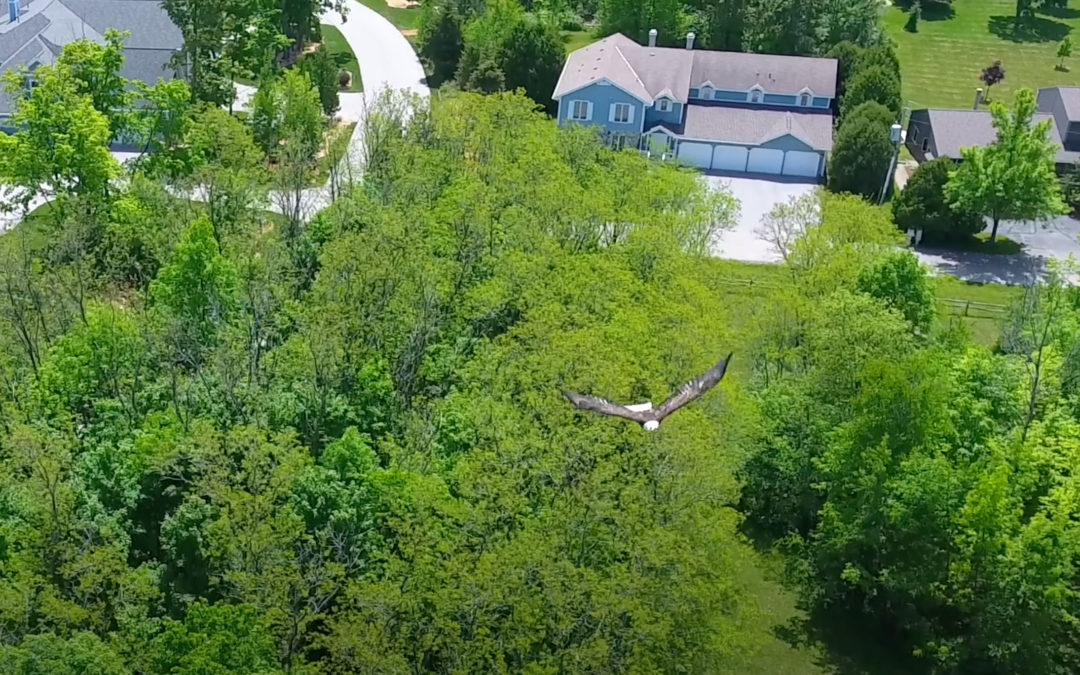
This Door County aerial imagery pairs a memorable bald eagle view with the surrounding Wisconsin landscape and destination context. The media can support scenic storytelling, tourism content, social posts, and other nature-forward Wisconsin visuals.

START YOUR PROJECT

Start With the Project Basics

Send the location, timeline, project type, and intended use. Above Wisconsin will help shape the right drone photo, video, or editing plan before you commit to a shoot.

Helpful details

Location | Timeline | Project type | Photos or video | Intended use | Site access notes
This field is for validation purposes and should be left unchanged.
We utilize the FAA facility map to check the flight regulations and ensure we have all of the correct permits needed to fly your project before arrival.
A sentence or two is perfect: service type, location, timeline, or how you want to use the media.
Door County Waterfront Home

Door County Waterfront Home

ABOVE WISCONSIN PORTFOLIO

Door County Waterfront Home Drone Photography

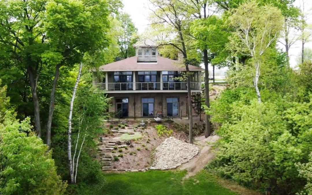
Aerial property visuals that show shoreline, access, setting, and surrounding Wisconsin landscape.

Location
Door County, Wisconsin

Project Type
Waterfront real estate, property marketing

Media Focus
Real Estate & Property, Tourism & Destinations

Useful For
Waterfront listing media, Property scale and access, Shoreline context

Tags
Real Estate & Property | Tourism & Destinations | Door County | Door County Drone Pilots

Project Media Preview

Door County Waterfront Home Drone Photography aerial portfolio image 1

THE NEED

What Needed to Be Clear

Waterfront homes are sold through more than the structure itself. Buyers need to understand shoreline, privacy, access, neighboring properties, views, and the surrounding destination context.

THE APPROACH

What the Aerial View Shows

Above Wisconsin used aerial photography to show the property as a complete location, giving real estate teams stronger visuals for listings, web pages, social posts, and buyer conversations.

Media Uses

  • Waterfront listing media
  • Property scale and access
  • Shoreline context
  • Real estate marketing visuals

PROJECT VIDEO

See the Waterfront Setting From Above

Watch the aerial video to view the home, shoreline, access, and surrounding Door County landscape together.

Door County Waterfront Home Drone Photography Above Wisconsin drone portfolio

WHY IT MATTERS

Why Waterfront Listings Need Aerial Context

Door County waterfront property marketing depends on showing more than the home itself. These aerial views bring the shoreline, access, surrounding land, and overall setting together for listings, web pages, social posts, and buyer conversations.

START YOUR PROJECT

Start With the Project Basics

Send the location, timeline, project type, and intended use. Above Wisconsin will help shape the right drone photo, video, or editing plan before you commit to a shoot.

Helpful details

Location | Timeline | Project type | Photos or video | Intended use | Site access notes

This field is for validation purposes and should be left unchanged.
We utilize the FAA facility map to check the flight regulations and ensure we have all of the correct permits needed to fly your project before arrival.
A sentence or two is perfect: service type, location, timeline, or how you want to use the media.
Sister Bay Wisconsin

Sister Bay Wisconsin

ABOVE WISCONSIN PORTFOLIO

Sister Bay Wisconsin Drone Video

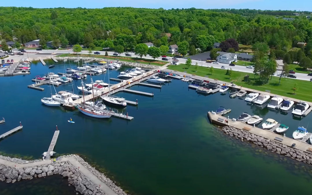
Door County aerial visuals that show destination character, shoreline, community setting, and visitor appeal.

Location
Sister Bay, Wisconsin

Project Type
Tourism, lodging, community, real estate

Media Focus
Tourism & Destinations, Real Estate & Property, Events & Community

Useful For
Door County tourism media, Lodging and destination visuals, Community promotion

Tags
Tourism & Destinations | Real Estate & Property | Door County | Door County Drone Pilots

Project Media Preview

Featured Aerial View

Project Perspective

Site Context

Additional Project View

THE NEED

Destination Context

Destination marketing needs to show why a place feels worth visiting. In Sister Bay, that means showing water, village layout, green space, businesses, and the larger Door County atmosphere.

THE APPROACH

What Above Wisconsin Captured

Above Wisconsin captured aerial media that helps communicate the feel of Sister Bay from above, giving tourism teams, lodging properties, and local brands visual context they can use across web and social channels.

Media Uses

  • Door County tourism media
  • Lodging and destination visuals
  • Community promotion
  • Social media content

PROJECT VIDEO

See Sister Bay From Above

Watch the aerial video for a broader view of the shoreline, village layout, green space, and destination setting.

Sister Bay Wisconsin Drone Video Above Wisconsin drone portfolio

WHY IT MATTERS

Destination Context From Above

Drone video gives viewers a broader sense of Sister Bay by connecting the shoreline, village layout, green space, businesses, and surrounding Door County setting. The footage can support tourism promotion, lodging content, community storytelling, and social media.

START YOUR PROJECT

Start With the Project Basics

Send the location, timeline, project type, and intended use. Above Wisconsin will help shape the right drone photo, video, or editing plan before you commit to a shoot.

Helpful details

Location | Timeline | Project type | Photos or video | Intended use | Site access notes

This field is for validation purposes and should be left unchanged.
We utilize the FAA facility map to check the flight regulations and ensure we have all of the correct permits needed to fly your project before arrival.
A sentence or two is perfect: service type, location, timeline, or how you want to use the media.
Door County Trolley

Door County Trolley

ABOVE WISCONSIN PORTFOLIO

Door County Trolley Drone Media

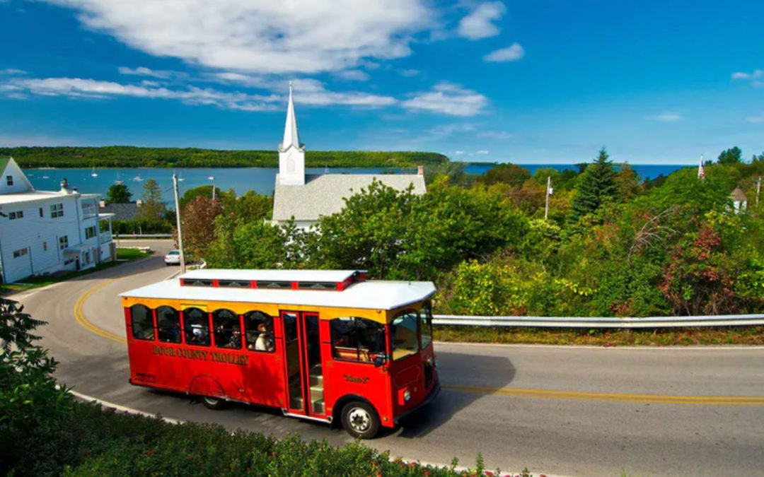
Destination-focused aerial media for a recognizable Door County tourism experience.

Location
Door County, Wisconsin

Project Type
Tourism, transportation, events

Media Focus
Tourism & Destinations, Commercial & Industrial, Events & Community

Useful For
Tourism business marketing, Destination experience visuals, Event and route promotion

Tags
Tourism & Destinations | Commercial & Industrial | Commercial Photography | Door County

Project Media Preview

Featured Aerial View

Project Perspective

Site Context

THE NEED

What Needed to Be Clear

Tourism businesses need to show experience, setting, and sense of place quickly. For a trolley or tour-based brand, viewers should understand the destination energy before they ever book.

THE APPROACH

What the Aerial View Shows

Above Wisconsin captured aerial media that supports tourism marketing, showing the Door County setting and giving the brand stronger visuals for web, social, ads, and visitor-facing content.

Media Uses

  • Tourism business marketing
  • Destination experience visuals
  • Event and route promotion
  • Website and social media content

PROJECT VIDEO

See the Destination Experience From Above

Watch the aerial video for a broader view of the Door County setting around this recognizable tourism experience.

Door County Trolley Drone Media Above Wisconsin drone portfolio

WHY IT MATTERS

Showing the Destination Around the Experience

Aerial media places the Door County Trolley experience within its wider destination setting, helping viewers understand place and atmosphere before visiting. The footage can support tourism marketing, event and route promotion, websites, advertisements, and social content.

START YOUR PROJECT

Start With the Project Basics

Send the location, timeline, project type, and intended use. Above Wisconsin will help shape the right drone photo, video, or editing plan before you commit to a shoot.

Helpful details

Location | Timeline | Project type | Photos or video | Intended use | Site access notes

This field is for validation purposes and should be left unchanged.
We utilize the FAA facility map to check the flight regulations and ensure we have all of the correct permits needed to fly your project before arrival.
A sentence or two is perfect: service type, location, timeline, or how you want to use the media.
Above Wisconsin LLC · 2159 Sunny Brook Dr, Green Bay, WI 54313 · (920) 434-9772 · Mon to Fri, 8 am to 5 pm · FAA Part 107 drone services since 2015